Daily Journal
December 3, 2004: Charting Your Course -
More about Longitude and Latitude

The cruise is under way!
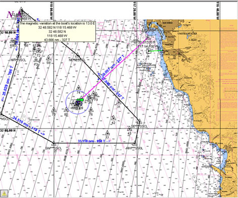
The New Horizon sailed from San Diego on December 3. On the first day out, Dr. Marta Torres worked on charting longitude and latitude coordinates. These coordinates will be used by the captain to sail the ship to the locations where the sediment and water samples will be collected.
What are latitude and longitude measurements?
The latitude of a point is measured in terms of its distance from the equator toward one of the earth's poles.
Any point on the equator has a latitude of zero degrees.
Question 1: Find the equator on a map or globe. What country is named for the equator?
Question 2: Locate the North and South Poles. What continents are the poles on?
Try this on a clear night: You can estimate latitude by pointing one arm at the North Star and the other arm at the horizon. The number of degrees of the angle between your arms is the latitude where you are.
All points on the earth that have the same latitude are on a circle called a parallel of latitude. The distance between 2 parallels that are one degree apart is about 60 nautical miles (equal to 69 land miles).
The other measurement needed to pinpoint a location is longitude. Longitude lines run north and south. Imagine a huge orange divided into 360 equal slices. The lines between the "slices" are called meridians. Meridians are the main lines of longitude on a map.
Question 3: What do the word parts hemi and sphere mean?
The earth is divided into two hemispheres of east and west longitude. Most countries begin counting lines of longitude east and west from Greenwich, England.
Question 4: Using a world map or globe, find London, England. Next find Paris, France. Is Paris east or west of the Greenwich Meridian?
Question 5: The New Horizon will be sailing to 32 degrees N latitude and 118 degrees W longitude to collect samples. Where will the ship be?
Back to Daily Journals

|


