

The Project
|
Daily JournalSeptember 22, 2004:
|
Vocabulary words to look for: DR position: Geographical position (GP): Global Positioning System (GPS): Greenwich Mean Time: Latitude: Longitude: |
The Fundamentals in a Nutshell
If you have ever been to sea in a small boat, the number one priority is determining your direction and your course. With today's electronic capability with a GPS (Global Positioning System) and satellite connection, latitude and longitude can easily be recorded. The skipper on a boat should never, however, depend on only one positioning instrument. The ocean is vast and position should be periodically checked by other means.
You know where you started from, the direction you went, the speed, and the length of time. From this information you lay out the course and distance on a chart, and mark the spot. This is called dead reckoning or DR.
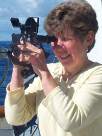
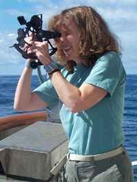
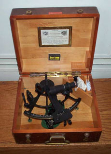
The other means of navigation is celestial. This quaint old art using a hand-held sextant does not depend on batteries, circuits, or satellite availability. It is the way position on the ocean has been determined for centuries. Why learn celestial navigation? It is a nice backup, but also, you are using the same artifact sailors of old used as they explored the oceans and claimed new lands around the world. Generating your position using the natural elements, the sun, the stars, the moon, and the horizon will merge your soul with the sea.
On board the Wecoma, we have learned the fundamentals of celestial navigation. We have developed an intimate relationship with the sextant and the countless corrections and calculations that are necessary to make sense of the initial shot of the sun. This is where the navigator puts her eye to the sextant, points it at the sun, and moves the scale until the sun reflected in the telescope touches the rim of the sea. At that instant another person records the exact time. Local time is translated to Greenwich Mean Time and then tables with columns of numbers and forms are used to make corrections and to determine the latitude and longitude to pinpoint the position of the ship.
Several shots of the sun need to be taken throughout the day. After calculating the latitude and longitude for each shot, the positions are then plotted on a compase rose (a circle with degrees printed around the circumference). The positions should be close to one another and show the course of your ship. Be sure and check this position with your DR and then rest easy and enjoy the journey.
Now, here's your math problem:
You are on the Pacific Ocean west of Newport, Oregon, and traveling north. Your latitude is exactly 44 degrees and you are traveling at 10 nautical miles/hour. What will be your latitude 30 hours later, providing you stay on the same course? (1 degree of latitude = 60 nautical miles)
The Crew (Part 4)
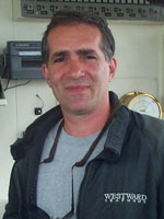 Rick Verlini, Chief Mate
Rick is a "local" living in Newport, Oregon, with his wife, son, and dog.
Before joining the Merchant Marines, he worked in commercial fishing in
Alaska for 20 years. He decided he wanted to work closer to home. While
looking for work, he took an aptitude test at Coast Community College in
Newport. He ended up landing himself a Chief Mate position and a 1600 ton
license. He has been with the Wecoma for six years. The favorite part of
his job is meeting people and going new places. He is gregarious and very
generous about sharing and teaching newcomers like us about celestial
navigation.
He uses math a lot in celestial navigation to calculate speed/miles, to estimate cargo loads, and arrival at locations. He uses formulas and scientific calculators to calculate lifting capacity of the boat's crane and the angle of lift.
His positive "can do" attitude is reflected in his advice to our students, "Stay in school, get as many degrees as you can, and be certain to go to college."
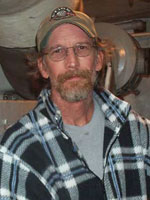 Chip Millard, Engineer
Chip calls Marcola, Oregon, home where he lives with his wife, two
children, and five horses. He grew up in Hawaii, so being on water and
working on boats are second nature to him. He has worked crew for yachts,
schooners, and fishing boats. He also worked as a marine educator in
Hawaii in a special education program that took students onboard a ship to
learn and explore.
He has been a Merchant Marine for 25 years and on the Wecoma for 7 1/2 years.. He uses math daily and is continually trying to upgrade his math skills. He calculates speed, gear ratio, and pressure and temperature. He says, "You are in much better shape to work on complex equipment if you know math." When something breaks at sea, the engineers must rely on their own skills and knowledge to make repairs.
He is philosophical about life onboard a ship and says what you do affects everyone. Teamwork is essential, be honest with yourself and others, it is too small of an environment to let problems build. Deal with each other honestly and respectfully, even if you must agree to disagree. If you make a mistake tell someone and report anything you may see, hear, or feel on the ship. The crew knows what things are supposed to sound like, they often can hear if something is wrong before seeing it. He also said, "Don't have any unsettled arguments before you come out here. You also have to be a human being."
![]()

