Daily Journal
September 16, 2004:
Teachers at Sea
HyperTSRB (Tethered Spectral Radiometer Buoy)
The TSRB is an instrument used to measure, among other things, the amount
of light reflected from the surface of the water. It can also measure
temperature of the ocean. This allows scientists to compare the amount of
chlorophyll microscopic organisms contain. This data can then be analyzed
to further understand the role of phytoplankton in the ocean. Light data
from the TSRB can also be compared to the light readings obtained from
satellite imagery.
Some satellites are programmed to read images reflected from the earth's
surface. For example, satellites can map great basins of ocean
chlorophyll. The data is used to estimate the amount of chlorophyll.
Satellite maps of the earth can show the relationships of parts of the
earth's surface to the whole. This has given us an entirely new vision of
our Planet Earth.
Information logged from the TSRB is compared to satellite data of the same
area. The satellite, because of its great distance from earth, is accurate
only to within 1 square kilometer. In an area smaller than this the data
becomes garbled and images can overlap, rendering them less useful.
Scientists attempt to compare and contrast data from the TSRB with
satellite data. If the data does not correlate, then scientists look for
factors that may have created these discrepancies. These factors may be
atmospheric conditions such as fog, clouds, smoke, or dust.
The technology of the TSRB is amazing to learn about. Equally fascinating
for us was the opportunity to see these instruments being deployed (put
into the sea) and then to see scientists retrieve the instruments from the
edge of a deck on a moving ship in 10-12 foot swells.
 
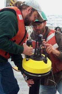
Above left: Sam and Daryl preparing
the
TSRB for deployment into the sea.
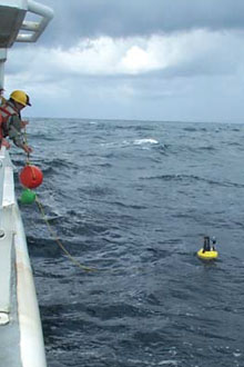
Above right:
Getting ready to retrieve the TSRB.

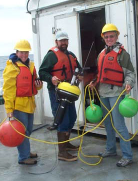
Amanda, Sam, and Kristin putting the TSRB away.

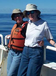
Annie and Susan keeping an eye on the TSRB.
Back to Daily Journals

|


